New Report Shows “Outdated” FEMA Maps Downplayed Camp Mystic Flood Risk
A new report criticizes FEMA’s flood maps for failing to consider flash floods and inland flood zones.
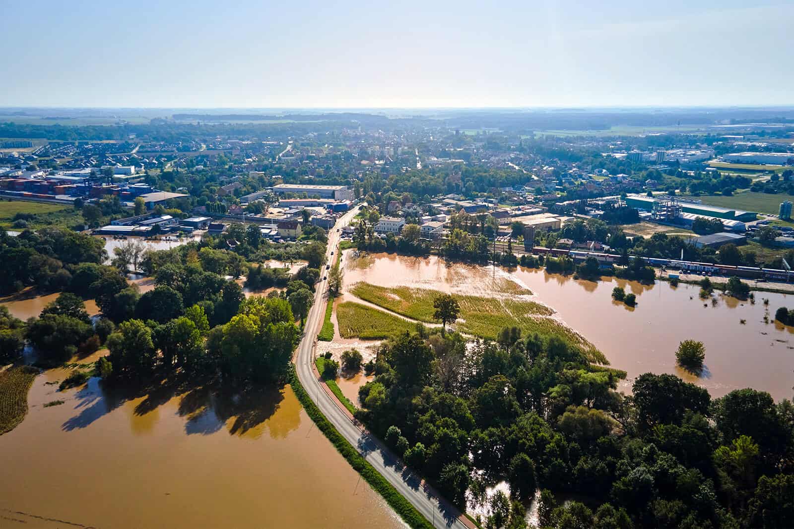
The report specifically highlights Camp Mystic, the kids’ camp devastated by the flash flooding of the Guadalupe River that occurred between July 4 and 7, 2025.
According to First Street, a New York City climate risk modelling company, at least 17 structures in Camp Mystic were in a high-risk area, with four cabins in a zone specifically listed as an “extreme flood hazard,” where water moves at the highest velocity and depth.
As NPR explains, FEMA’s flood reports have traditionally failed to consider rainfall and flash flooding. Instead, they focus on coastal storm surges and large river flooding.
First Street and other startups, meanwhile, take a different approach to risk modeling. A growing number of homeowners, business owners, and insurers are using this risk modeling to make predictions in a different – and possibly more accurate – way.
Twice As Many Americans Live in Dangerous Flood-Prone Areas
First Street’s risk modeling system accounts for rainfall and flash floods – not just coastal storm surges and large river flooding.
That risk modeling system paints a much different picture of flood risks across the United States.
In fact, according to First Street, the number of Americans who live in high-risk flood areas is twice the number reported on FEMA’s “outdated” maps.
4,500 Homes in Kerr County Are in High Danger Areas – 76% More than FEMA Predicted
According to FEMA, 2,560 homes in Kerr County are at risk of flooding.
According to First Street, however, more than 4,500 homes are actually in danger of flooding.
Because First Street’s model considers rainfall and flash floods, it puts some houses in a high-risk zone even when those houses are in FEMA’s low-risk zone – like Zone X.
At Camp Mystic, for example, several of the cabins were partially within FEMA’s flood zones while wholly within First Street’s flood zones. Those cabins were significantly affected by the recent flooding.
Properties in Zones C or X (unshaded) on FEMA flood maps are an “area of minimal flood hazard.”
Many of those same Zone C or X properties, however, have a higher risk on First Street because of nearby ponds or rivers, both of which are prone to flash floods. While FEMA considers major rivers and coastal flood areas, it may pay less attention to smaller rivers, floodplains, and inland flood zones – like the Guadalupe River.
Some Developers Ignore Flood Zones Altogether
First Street may be trying to flex on FEMA’s “outdated” data in the wake of the Guadalupe River tragedy of June 2025.
However, none of this flood data matters if developers ignore the regulations entirely.
At least eight of the cabins at Camp Mystic were in an area designated as a floodway, for example.
A floodway is the most dangerous area of a floodplain; it’s the area where the deepest water flows the fastest during a storm.
As one analyst explained in an interview with NPR, floodways are “the most dangerous area of a danger zone” and “no one should be in a floodway.”
Officially, FEMA prohibits development in floodways. Many of Camp Mystic’s cabins, however, were built nearly a century ago.
Making things worse, many Texas officials didn’t take floodplain restrictions seriously because it had been decades since there was a severe threat. Many of the floodplains were dried riverbeds that had gone 45+ years without a severe event.
Here’s how Jim Blackburn, co-director of the Severe Storm Prevention, Education and Evacuation from Disaster Center at Houston’s Rice University, explained the difficulty in a statement to NPR:
In Texas, we don’t think floodplains are that serious. We treat floodplains as a kind of good old boy…it’s environmental red tape. And that’s going to get a lot of people killed.
Kerr County, to its credit, passed two ordinances in 2020 to address floodplain risk. Those ordinances, Order Nos. 37967 and 38000 are designed to “minimize public and private losses due to flood conditions in specific areas.”
Home Developers Lobby for Less Flood Regulations
It’s no mystery why flood zone risk maps vary across the United States; it’s partly because of lobbying pressure.
According to a recent investigation by NPR and Frontline, home developers’ associations lobby Congress for less flood regulation.
In some cases, these lobbying groups even encourage Congress to delay updates in the nation’s flood maps.
Developers argue they’re trying to keep homes affordable. Critics argue they’re risking lives while chasing profits.
Is it Time for a “Managed Retreat” from High-Risk Areas?
The future of floodplain management could get worse.
According to Chad Berginnis, head of the Association of State Floodplain Managers, the Trump Administration is reducing flood risk analysis funding, making it harder for small communities to accurately predict floods in the future.
Here’s how Berginnis explained the challenge:
When I look at the flood map in the area of Camp Mystic, there is a small water course that comes in right there that doesn’t have good flood mapping data.
Ideally, floodplain experts would analyze the area and make accurate predictions for the future.
Unfortunately, as federal funding disappears, it’s becoming harder – not easier – to analyze local risk factors:
The action is simple. Get the notice of federal funding opportunities out and get those grants approved for funding. Those are things right off the bat that the administration could do.
In the meantime, floods kill thousands of people each year. In 2024, 19 million people were displaced by flooding.
Storms and floods have become less deadly in recent years as experts become better at analyzing risks, but as the intensity of extreme weather events rises, some are calling for a “managed retreat” to permanently move people out of harm’s way.
Residents of Texas affected by flooding or storms since July 2, 2025 can check for government assistance through DisasterAssistance.gov:
- Visit https://www.DisasterAssistance.gov/
- Use the FEMA mobile app.
- Call the FEMA Helpline at 800-621-3362, which is open 6 am to 10 pm CST and available in multiple languages
Or, learn more about assistance and options here.